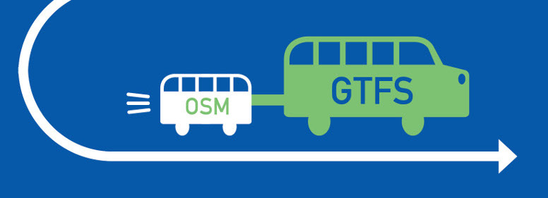
To map a transit network, it’s great to co-create data in collaboration with the OpenStreetMap community. It’s also essential to rely on the GTFS standard.
With no doubts, our choice is to map the transit networks in collaboration with the OpenStreetMap local communities. GTFS conversion happens a posteriori.
However it is also possible to it backward. You can compare the two approaches in our detailled infographic.
Trust the OpenStreetMap community
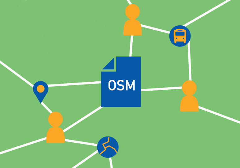
At Jungle Bus, when we focus on a specific city, we start as soon as possible the collaboration with the local OpenStreetMap community members. It’s not only because we are involved OpenStreetMap contributors!

Their knowledge of the field and the context are indeed valuable assets to take into account local specificities and build data that fits to the reality. It is all the more necessary that the cartography of the transports exceeds in general the simple framework of the GTFS: the position and the classification of the roads where the buses circulate, the pedestrian paths to reach the stops or the available equipments are as much of useful information. OpenStreetMap also allows you to contribute all this data: the contributors have already started this meticulous task.
This undoubtedly increases the quality of the data produced and allows local appropriation: contributors “feel responsible” for the data of their own city and invest more time, for example by using the free Android Jungle Bus application (description in French but app available in English and more languages). This leads to more regular updates and better quality.
Durability and sharing
The 320 local transport local lines, tro-tro, have been mapped by the local community during summer 2017 with Jungle Bus support to create a transport map and a GTFS file. You can read more about the project in our dedicated article (in French).
More than 2 years later, the local community has maintained the data, in collaboration with a local start-up! This “natural” appropriation can only take place if it is planned upstream, accompanied during the initial mapping project and OpenStreetMap is particularly well suited to it.
By entering transport data directly into OpenStreetMap, the data is opened from the first day: all stakeholders can discover and use the data as they are created. Beyond the storage and distribution, OpenStreetMap offers a true collaboration platform where the different people involved in the project can share the tasks of creation and verification of the data.
The OpenStreetMap data, in addition of being updated by the local community, is much more shared and used than a simple GTFS open data file.
The OpenStreetMap community is already structured both locally and globally: it has means of communication, documentation and collaborative sharing, etc. These tools are used daily by thousands of contributors and reusers every day.
Easier use of the data
By first relying on OpenStreetMap, the data is standardized between the different networks and dedicated tools are available in Free Software.
In particular, we can mention osm-transit-extractor which allows specific exports for transport, or osm2gtfs to export data directly to GTFS format (stops, line layout and schedules included).
Jungle Bus uses and contributes to both tools. Indeed, for several years, we have been participating in the improvement of OpenStreetMap community tools and creating missing bricks to work on public transport; all our tools are under free license and usable by all.

Do you have a project to map a transport network? We can help you implement an innovative co-authoring methodology in your project to make your data more resilient.